
Oxfordshire is a county in South East England. It is situated on the North Sea-Mediterranean TEN-T corridor. Oxfordshire cities’ transport networks have historically been developed to provide access to city centres. New areas of growth require appropriate levels of access and strengthened linkages.
Oxfordshire is home to around 666,000 people, an increase of over 10% in the past decade. The county is divided into five district council areas, with a quarter of the county’s residents living in Oxford city. It is home to nearly 30,000 businesses, providing over 380,000 jobs. It sits on the busy road and rail transport corridor between the south coast ports, the Midlands and the north and enjoys easy links to London and West Midlands. The county is the second more rural area at the UK’s South East, with a combination of urban (both historic and modern), peri-urban, highways and rural locations.
HARMONY in Oxfordshire
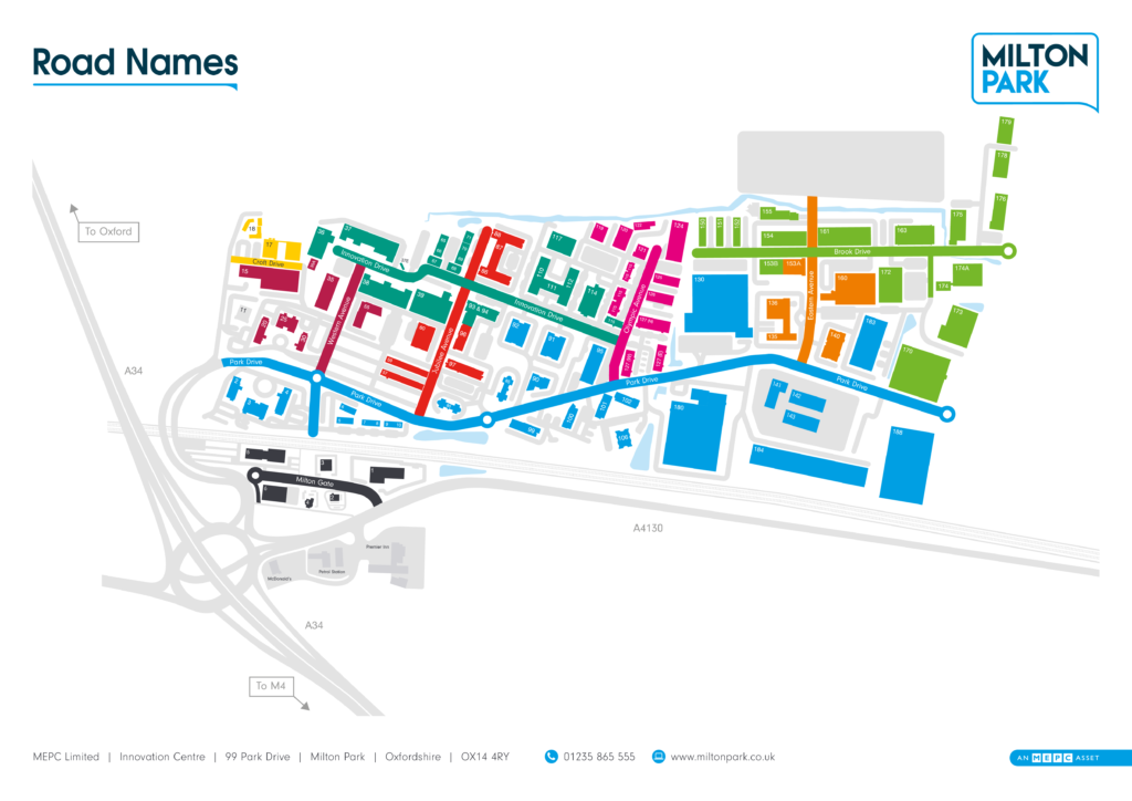
The pilot demonstration will be conducted at Milton Park. It is a science and technology park, a collaborative working environment and a welcoming community that fuels innovation and sustainable growth for more than 250 businesses. The Park sits within the Technology Arc and Golden Triangle which encompasses a strategic area of science and technology businesses between Oxford, Cambridge and London. HARMONY will:
- engage and work with regional, national and international stakeholders and citizens in co-creation labs;
- integrate and demonstrate electric AVs for passenger and freight and heavy-lift drones;
- collect primary data;
- apply the model suite;
- recommend updates for the regional spatial and transport planning strategy.
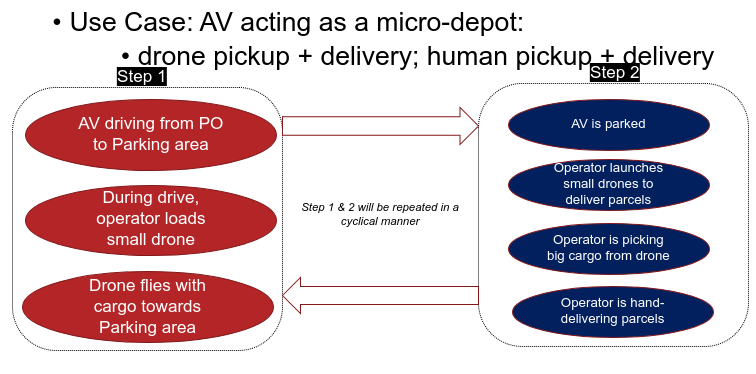
This pilot will enable the transport of essential medical supplies from the ambulance centre to locations of need within the park, showcasing faster connectivity and reliable journey times for the use case. There will also be integration with CAVs to trial delivery of parcels within the business park.
The freight trials will be conducted in partnership with a logistics operator to showcase facilitation of delivery using Connected and Autonomous Vehicles (CAVs) and Unmanned Aerial Vehicles (UAVs). The route of the drone will be within the confines of the business park. The flight management of the drone provided by GRIFF Aviation will be done using AIRBUS’ UTM (Unmanned Traffic Management) platform. The integration with the autonomous vans provided by ARRIVAL will be a scenario that highlights the speed and efficiency of freight delivery using a combination of future mobility technologies.
The passenger trials will be conducted using the autonomous bus provided by ARRIVAL. Frequent visitors within the business park will use these buses for journeys and their progress will be tracked using a mobile application to better understand their commuter patterns and behaviour models.
The facilitation of these trials will require close interaction with the Urban Traffic Management Centre who will also be part of a co-creation workshop in the future to understand the integration between road and air traffic. Transport planners within Oxfordshire County Council will provide input to the modelling partners to help fine-tune the different models.
The key challenges that are being targeted as part of this UAV + CAV demonstration are speed, efficiency and coordination. This project proposes to tackle these challenges by looking at new mobility services that can provide a faster mode of travel (and thus provide time gains) in conjunction with existing delivery mechanisms to provide minor interventions that can better utilise the system. The smooth implementation of such a project combined with rigorous exercises on social acceptance and integrated policy requirements will enable scalability and replicability.

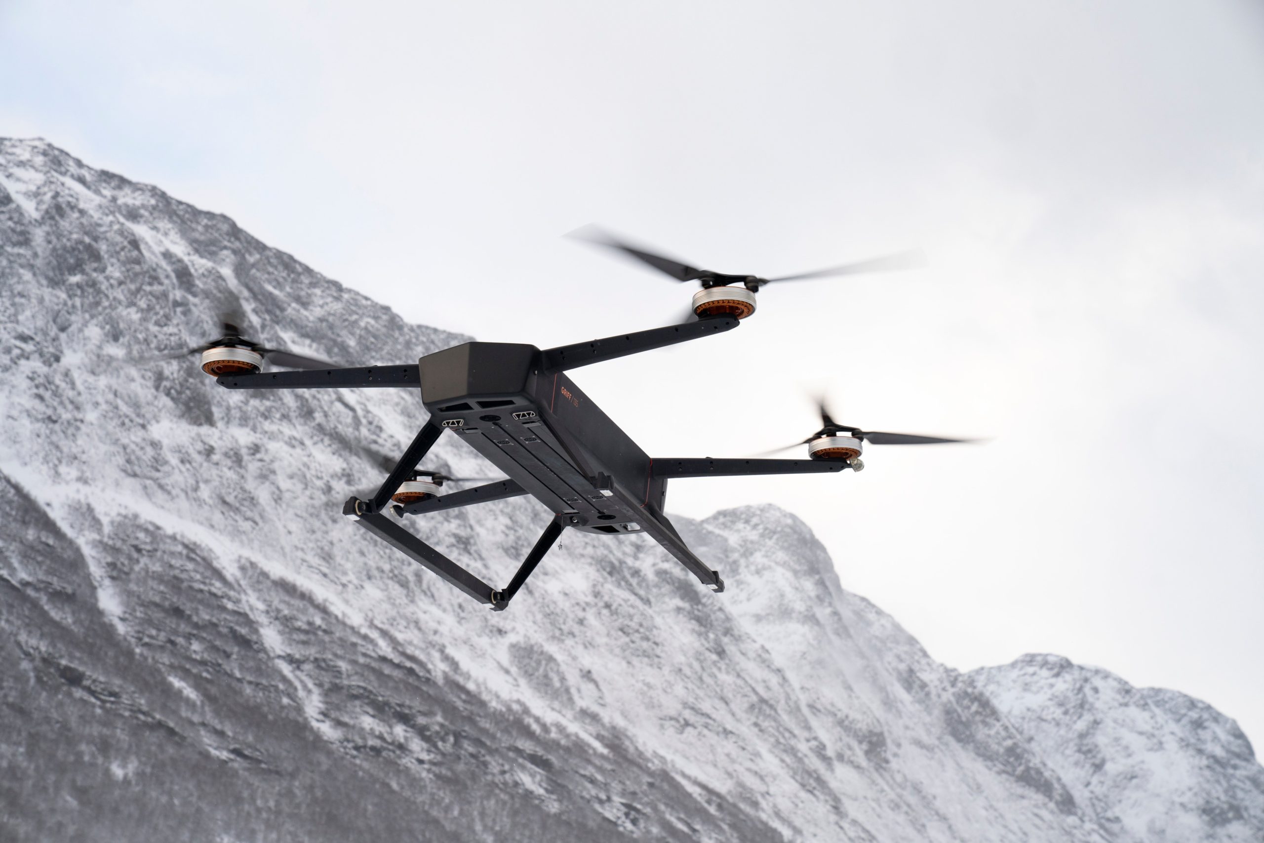
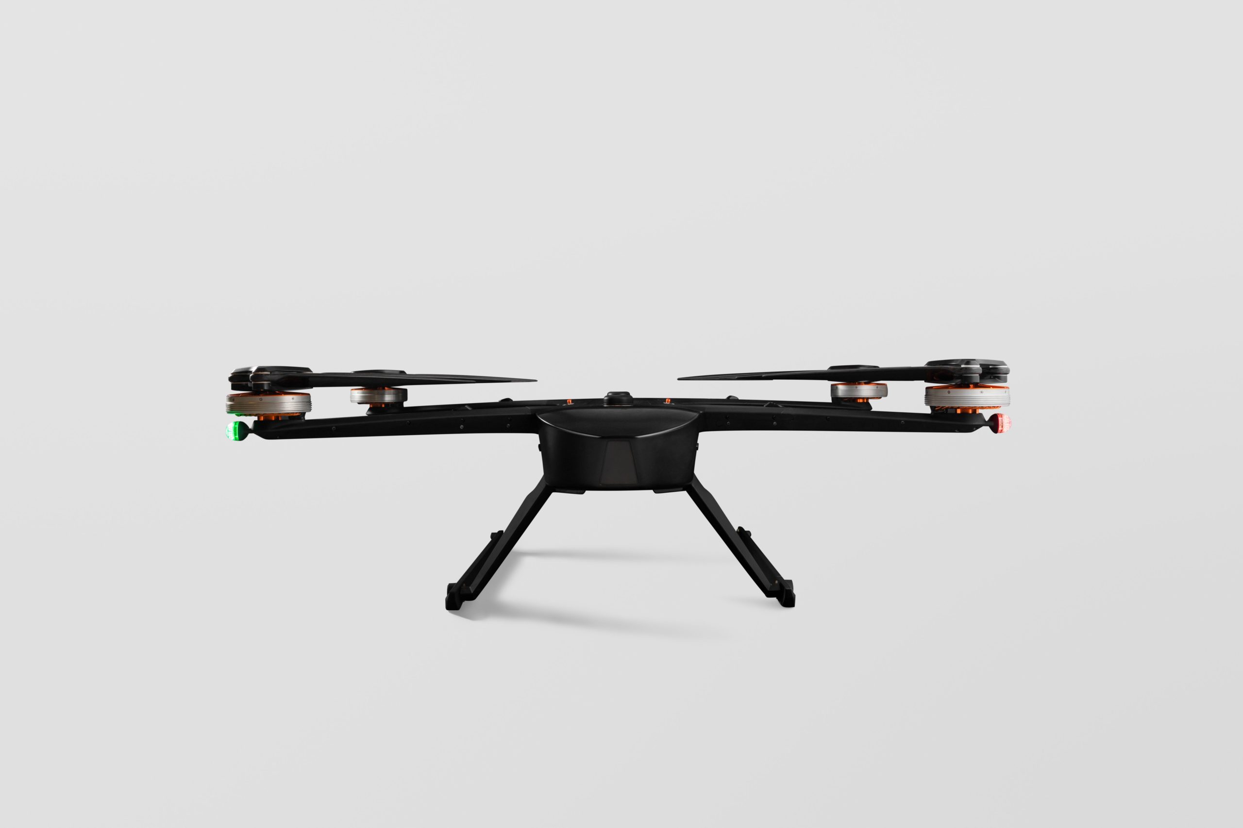
The drones by GRIFF Aviation that will be used during the HARMONY demo in Oxfordshire.
As part of the the demonstrations and co-creation activities, the following activities have been carries out so far:
- Initiation of meeting with all stakeholders (Oxfordshire County Council, UCL, AIRBUS, GRIFF) at the proposed site for demonstration – Milton Park (MP). Multiple discussions on use cases for CAV and UAV trials to help to identify use cases and zone of operation and to create a template (along with UCL) to help manage the demonstrations.
- Discussion with Civil Aviation Authority (CAA) on the regulatory approval application process.
- Discussion with planners – transport, land use, strategic.
- Literature review of strategic planning documents, review of EU guidelines on SUMP appraisal.
- Performing methodologies suggested by the EU on Oxfordshire COunty Council SUMPs.
- Identification of KPIs based on review of planning documents and multiple collaborative meetings with planners.
- Review of focused Steering Group documents (Active Travel, Cycling, etc.) to identify stakeholder needs.
- Discussions on data-access and data-sharing – Involved in meetings with different organisations within the County Council such as: GIS, land use, demographics and external partners.
- Participation in Atkins Digital Survey on UAV demonstration: Comprehensive questionnaire on goals, challenges, details of UAV and CAV demo at Milton Park.
- Details on questionnaire and survey for primary data collection: needed for raising procurement requests at OCC – MOBY.
- Completion of data-sharing agreements for secondary data.
In the next months, we will:
- Help UAV partners make approval applications to the regulatory body (CAA);
- Finalise primary data collection methodologies and means of conducting surveys;
- Set up a workshop to facilitate integration between different transport management control centres;
- Help UAV partners perform safety case assessment and community engagement with pilot area;
- Organise online workshops with planners, modellers;
- Survey companies to begin primary collection exercise.